
Helpful Online Resources -WildfireRisk.org-
Is Your Community Safe? Breaking Down the Wildfire Risk to Communities Tool
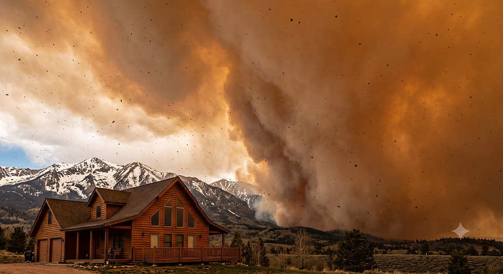
Living in beautiful, nature-adjacent areas often comes with an unspoken trade-off. We get the stunning views, the dense forests, and the fresh air, but we also shoulder the increasingly harsh reality of wildfire season. Whether you live right on the edge of a national forest or nestled in a suburban valley, understanding your community's actual risk is no longer just for firefighters or urban planners—it is essential knowledge for every homeowner.
Recently, our team at Rocky Mountain Wildfire Mitigation (RMWM) sat down to explore a highly useful digital resource: Wildfire Risk to Communities. Let's break down what this tool is, how it works, and why looking up your hometown might just be the most important thing you do today.
What is Wildfire Risk to Communities?
The website, located at wildfirerisk.org, is a free, interactive platform created by the USDA Forest Service. It is designed specifically to help local leaders, planners, and everyday residents understand and explore their wildfire risk. Before this tool was developed, it was incredibly difficult for the average person to access nationwide data without a background in mapping or data analytics.
Now, the data is aggregated into an easy-to-use interface that requires absolutely no technical or mapping skills to navigate. It provides nationwide maps and charts showing the risk to homes, wildfire likelihood, and information on vulnerable populations. Whether you are an elected official trying to prioritize mitigation efforts or a homeowner deciding where to focus your landscaping budget, this site is an incredible starting point.
Walking Through the Tool with RMWM
If you haven't seen it yet, be sure to watch our latest RMWM video where we check out the site in real-time. We wanted to share this resource because we have found it incredibly helpful for visualizing abstract concepts like "fire danger" and turning them into concrete, localized data.
Here is a breakdown of what we discovered during our video walkthrough:
1. Understanding Your Risk
Right on the front screen, you will find the Understand tab. This section breaks down exactly how the site calculates risk. It isn't just about how close you are to the trees. The site uses a simple but powerful equation:
Hazard x Vulnerability = Risk
Hazard: This encompasses the likelihood of a fire starting and the intensity it might reach based on topography and vegetation.
Vulnerability: This looks at exposure (is your home directly in the path?) and susceptibility (how easily could your home ignite?).
When you multiply these factors together, you get a much clearer picture of what your community is truly facing.
2. Exploring Your Community Data
In the video, we clicked over to the Explore tab to put the tool to the test. You can type in the name of almost any city, tribal area, or county in the United States. For our test run, we looked at Golden, Colorado.
The results were immediately striking. The tool revealed that Golden has a very high risk of wildfire. In fact, the data showed that Golden's risk is higher than 95% of communities in the U.S.
When we clicked into the "Risk to Homes" map—which utilizes models updated as recently as 2024—we could see exactly how the danger was distributed. The model looks at the land, the vegetation, and the likelihood of different events occurring there. Visually, the map paints a very clear picture. While some eastern areas of Golden don't look overly vulnerable, the western side of the community glows with a deep, alarming red indicating severe vulnerability.
3. Comparing the Data Nationwide
One of the most fascinating features we highlighted in the video is the scatter plot comparison. The tool doesn't just grade your city in a vacuum; it plots your community's risk against others across the country.
Looking at the chart, we could see Golden sitting up there on the higher end of the spectrum, alongside places like Alta, California. On the flip side, towns like Everett, Pennsylvania, sit comfortably in the middle of the pack, while Farm City, Illinois, rests safely on the lower side. While Golden isn't at the absolute top, it is uncomfortably close, proving that the risks associated with this location are significant and demand immediate attention.
From Awareness to Action
Staring at a bright red map of your hometown can be intimidating. However, the goal of Wildfire Risk to Communities is not to incite panic. It is to spur action.
As we emphasized at the end of our video walkthrough, the website actively encourages you to take steps before a wildfire comes. You don't have to wait for a red flag warning to start protecting your property. The platform shares vital steps communities can take to mitigate risk through home hardening, wildfire preparedness, and fuel treatments. Here are the primary areas you can focus on today:
Defensible Space: Create and maintain a buffer zone between your house and the grass, trees, shrubs, or any wildland area that surrounds it. This is your home's first line of defense against creeping flames.
Home Hardening: Ensure your home is built or retrofitted with fire-resistant materials. From your roof to your siding to the mesh on your vents, the materials you use matter immensely when it comes to deflecting flying embers.
Community Involvement: Wildfire mitigation is a team sport. Get involved in your community and know what the official fire plan and evacuation routes are for your city.
Final Thoughts
We highly recommend heading over to wildfirerisk.org to type in your own city. The maps are eye-opening, and the data is invaluable. Knowing your risk is the very first step in effectively reducing it.
If you discover that your community is in a high-risk zone—just like we saw with Golden, Colorado—don't wait for the inevitable. Take the data, make a plan, and start working on your d
efensible space.
At Rocky Mountain Wildfire Mitigation, we are always here to help you navigate these realities. Check out the full video for our complete visual walkthrough, and let's work together to keep our homes safe, resilient, and prepared for whatever the fire season brings.


Comments